Forests across Europe are undergoing a digital transformation, not just from above, with satellites and drones, but also on the ground. New field survey technologies are reshaping how we measure, monitor, and manage forest ecosystems. These tools empower foresters, landowners, and researchers to collect accurate, real-time data directly from the forest floor. Whether using mobile apps, smart sensors, or precision instruments, these innovations are deepening our understanding of forest dynamics and enabling smarter, more sustainable decisions.
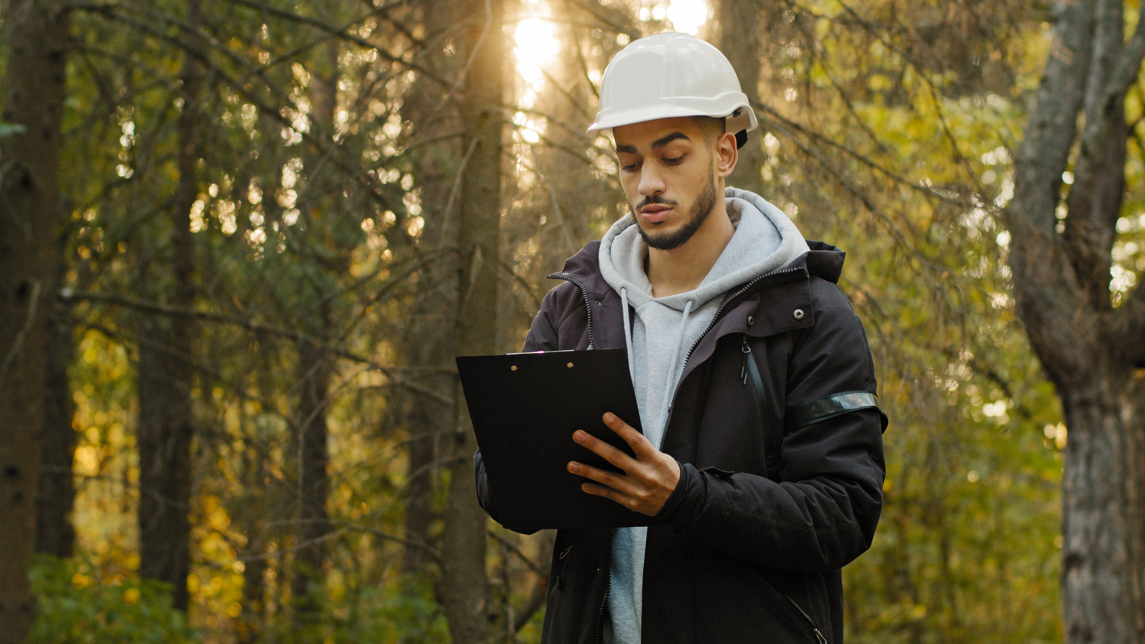
Field survey technologies include a wide range of portable tools and mobile platforms that allow users to assess forest conditions directly on site. Unlike remote sensing, which gathers data from afar, these technologies place monitoring power into the hands of forestry professionals in the field. Many modern mobile applications replicate desktop functions for offline use, enabling users to navigate maps, record forest health data, and carry out legal or operational tasks without needing an internet connection.
Some apps integrate satellite data to track deforestation or canopy health, while others use machine vision to convert simple photos into quick estimates of tree volume or density. By delivering real-time insights, these tools support fast, evidence-based decisions, whether it’s spotting early signs of disease, prioritising interventions, or fine-tuning forest thinning operations.
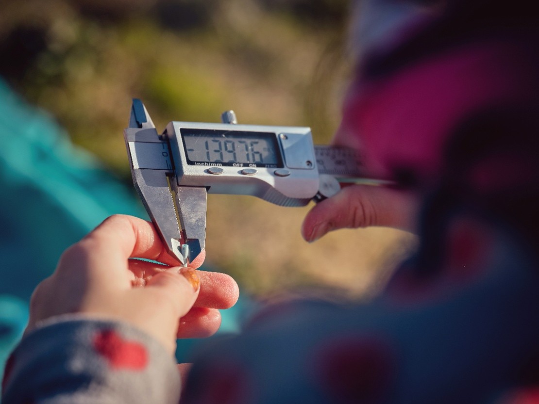
Field survey technologies are significantly improving the precision of forest inventories and ecological assessments. Instruments such as digital calipers, rangefinders, clinometers, and hypsometers enable foresters to measure tree diameter, height, and slope with high accuracy. Complementing these are soil moisture and temperature sensors, as well as handheld spectroradiometers, which provide deeper insights into site conditions and plant health, crucial for anticipating threats like drought stress or pest outbreaks. In difficult or remote terrain, robotic Unmanned Ground Vehicles (UGVs) offer a safe and efficient solution, collecting data without putting field personnel at risk and extending monitoring capabilities into previously inaccessible areas.
Across Europe, field survey technologies are becoming vital tools in modern forest management. Public agencies and private forestry companies increasingly rely on them for tasks such as carbon stock assessments, forest inventories, and biodiversity monitoring. These devices are also gaining ground in environmental research and conservation planning, where they support activities like fire risk mapping and habitat restoration.
While adoption varies by region and organisation, some clear trends are emerging. Tools that support offline planning and mobile inventory are widely used, reflecting the sector’s need for flexibility and precision in the field. Meanwhile, mobile apps for daily forest operations and on-site data collection are growing in popularity, though uptake remains slower among smaller landowners or in less digitally connected areas.
A promising direction is the integration of multiple tools, combining soil sensors, GNSS, and UGVs for example, to deliver a more holistic view of forest conditions. These toolkits enhance environmental risk monitoring, enabling users to identify drought-prone zones, track post-storm impacts, or detect subtle shifts in forest health. When applied consistently, they not only inform local decision-making but also strengthen broader climate resilience strategies.
Field survey technologies bring a wide range of benefits to forest management. Chief among them is efficiency. By streamlining data collection and processing, these tools reduce the time and cost of fieldwork while significantly improving the accuracy of forest assessments. They also enhance responsiveness, enabling managers to act quickly when problems arise, whether addressing a pest outbreak or adjusting land use plans to reflect changing conditions.
Accessibility is another key strength. Mobile-enabled tools allow forest owners to monitor even remote plots, while offline features make them practical in isolated or poorly connected areas. This is especially valuable for smaller operators who may lack access to aerial surveys or third-party services.
However, these technologies are not without limitations. Many require training and a certain level of technical literacy, and errors in data collection or interpretation can compromise results. High upfront costs may also be a barrier for smaller organisations. In areas with limited connectivity, reliance on mobile devices can hinder performance, and while offline modes help, they often lack full functionality. Additionally, syncing data across platforms and ensuring device compatibility remain persistent challenges.
Cloud Capabilities and Data Sharing
One of the most transformative shifts in field survey technology is the growing use of cloud computing. Data gathered in the field, whether GPS coordinates, tree measurements, or photos, can now be uploaded, stored, and processed in the cloud. This enables real-time synchronisation across teams, improves data transparency, and fosters more collaborative analysis.
Cloud-based systems also make it easier to integrate field data with other sources, such as satellite imagery, aerial surveys, or climate datasets, offering a more complete picture of forest conditions. Yet, despite these advantages, many forestry workflows still rely on local storage or offline tools. Broader adoption of cloud infrastructure could unlock major opportunities, supporting large-scale forest monitoring, streamlining cross-border collaboration, and advancing ecosystem-level decision-making.
Field survey technologies are becoming an integral part of modern forest management. As these tools continue to grow more affordable, user-friendly, and interoperable, their potential to advance climate-smart, sustainable forestry will only expand. By investing in training, digital infrastructure, and connectivity, stakeholders across Europe can ensure these innovations are fully leveraged, protecting forest ecosystems while supporting the communities that rely on them.
What tools have you used in your fieldwork? Are there technologies you’re curious to try? Join the conversation and help us shape the future of digital forestry.
Join the conversation and help shape the future of smarter, more sustainable forestry. Share your insights through our survey: https://wur.az1.qualtrics.com/jfe/form/SV_3ZYlHCXhpiDJyyq
Stay tuned as we continue to explore the digital landscape of European forestry, providing data-driven insights that help us all grow smarter and more sustainably.
Sign up to stay informed of news, key outputs and upcoming events!